Home> Apps
Apps
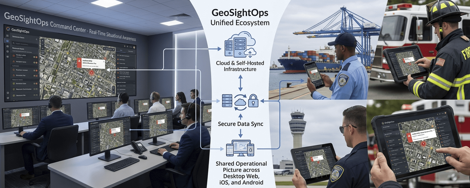
GeoSightOps by TechMaven Geospatial — real-time geospatial command and control. Self-hosted or cloud, NIMS ICS aligned, built for ports, airports, public safety, and critical infrastructure. Use the same operational picture in the control room and in the field. Native and web clients share authentication, maps, dashboards, incidents, and alerts so nothing fragments across “another app.”
Available on
Web
Full command UI in modern browsers
iOS
iPhone & iPad for patrol and inspections
Android
Rugged devices & phones
Windows
Desktops & touch kiosks
What you get in every client
- Common Operating Picture, monitoring, incidents, dashboards, and video aligned to the same records
- Offline-friendly mobile capture where your program requires it, with sync back to command
- Deployment choice — cloud or customer-controlled — without changing the product story for operators
Request access or a walkthrough
Tell us your platforms and hosting preference — we’ll map the right client mix and rollout path.