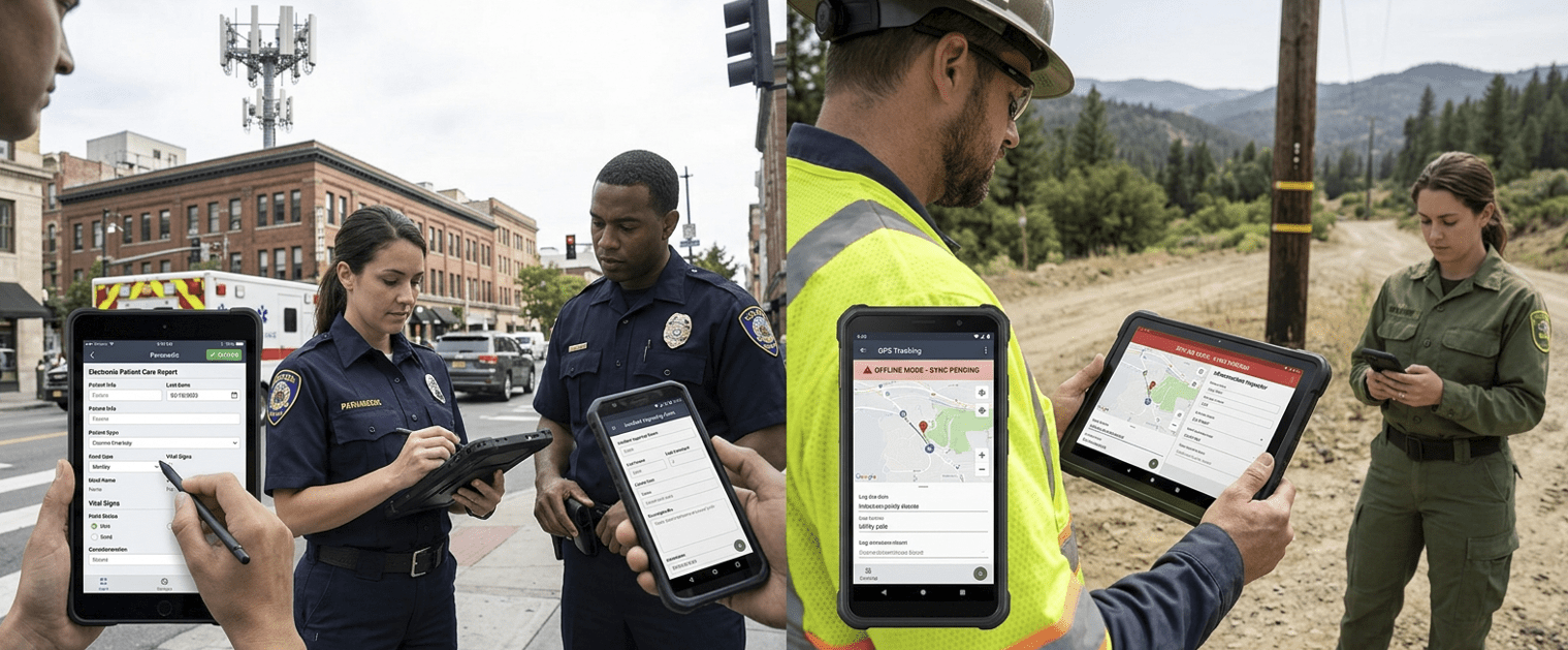
GeoSightOps mobile apps put the same governed forms, maps, and tasks in responders’ hands — on phones and tablets built for public safety, utilities, and field inspections. Capture structured data at the edge, attach photos and signatures, and keep working when connectivity drops; when the network returns, submissions reconcile with the Common Operating Picture and dashboards command already watches.
Digital Forms in the Field
- Incident reporting, patient care reports, maintenance checklists, and agency-specific templates — validated before sync
- Split layouts that pair maps with data entry so crews see where they are while they document what they observe
- Designed for rugged devices and stylus-friendly workflows where gloves and weather matter
Offline-First & Sync
- Queue submissions when towers or mesh links are unavailable; clear “sync pending” states keep operators informed
- Conflict-safe replay so rural corridors, tunnels, and disaster zones do not lose hard-won field notes
- Same identities and policies as the web app — mobile is an extension of command, not a shadow IT copy
Location, Media & Handoff
- GPS-tagged records and tracking views tie each entry to map features the COP and dashboards consume
- Photo, video, and audio attachments preserve evidence-grade context for investigations and QA
- Hand off cleanly to tasks, incidents, and reports so nothing stops at the device
Custom Integrations via Webhooks
GeoSightOps supports custom integrations with any third-party system through webhook configuration and its API-first architecture. Fire webhooks when mobile submissions sync so CAD, RMS, EHR, or CMMS systems stay current without manual re-keying.
Why It Matters
- Truth is captured where the event happens — not hours later from memory in an office
- Offline resilience keeps rural, maritime, and disaster footprints productive when the network cannot be trusted
- Command sees the same structured payloads the field submitted — fewer transcription errors and faster coordination
- One platform for patrol, inspection, and mutual-aid teams instead of a patchwork of consumer apps
Ready to see GeoSightOps in action?
Schedule a live demo and we’ll show you exactly how GeoSightOps integrates with your existing systems.